| Forest Cover |
|
MRPP / REDD has its focus in the allocated 24000 Ha plot which is part of the future Lalan Forest Management Unit (FMU). The Lalan FMU again is part of the Merang Peatdome ecosystem with an approximate area of 240.000 Ha in total. A project based approach is used. Trends in Forest Cover
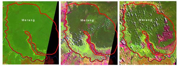
1998 1999 2007 It is envisaged to analyse and view historical and present land use scenarios, to identify leading drivers of the land use change during a period of between 10 to 30 years at the project site. The analysis results within the context of Lalan FMU area will be used for future projections with regard to the rate and location of future deforestation and forest degradation at project site, the Lalan FMU and could be even used for the region. The project site presently selected is approximately 24.000 hectare within the Merang peat swamp forest area. This specific and selected area is used for developing and testing a set of methodologies, technologies on forest and carbon monitoring, forest rehabilitation and integrated community development. The Merang Kepayang Peat Swamp Forest area was selected as it is a promising location for such a pilot project due to the relatively intact forest cover in some parts and the large below ground carbon storage in the peat, as well as the connections to the neighboring protected areas of Sembilang National Park and Berbak National Park. Recent Forest Cover
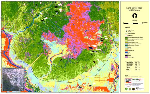
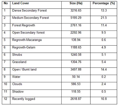
On recent MRPP analysis of the forest cover, it was divided into:
|
|
|


